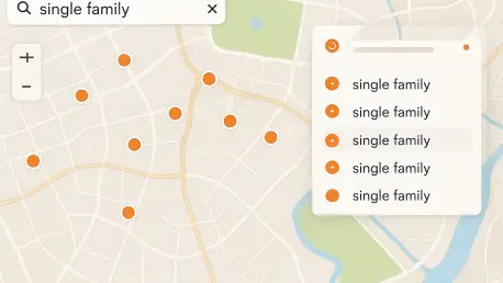

Building applications that synchronize programmatic search settings with ArcGIS Online webmap configurations ensures consistency between administrative portals and custom user interfaces. The transition toward more sophisticated spatial discovery tools is a defining trend in 2026, as users expect web applications to mirror the speed and intelligence of modern search engines. The release of the ArcGIS Maps SDK for JavaScript version 5.2 addresses these expectations by refining the arcgis-search component, transforming it into a highly configurable engine. This update emphasizes the utilization of full-text indexing, which allows for significantly faster and more intuitive interactions with complex datasets. By decoupling search logic from simple prefix matching, the SDK provides developers with the tools to handle nuanced queries, such as multi-word place names or administrative codes, with ease. This ensures the digital experience remains consistent, whether using an ArcGIS Online ecosystem or a custom application.
Implementing Advanced Search Modes
Replacing Exact Match with Search Mode
In previous versions of the SDK, developers were often constrained by a binary choice when configuring search behaviors, primarily through the use of the exactMatch property. This boolean approach forced a decision between finding an identical string or performing a basic trailing-wildcard search, which frequently failed to accommodate the reality of how users input data. The version 5.2 update resolves this limitation by introducing the searchMode property, which offers four distinct values: simple, starts-with, full-text-starts-with, and full-text-simple. Each of these modes provides specific logic for how queries interact with spatial layers, allowing for a much finer degree of control over the user experience. For example, the starts-with mode effectively replaces the legacy wildcard setting, while the new full-text options leverage indexed data to find relevant features even if the user does not begin their search with the first word of a formal title or name.
The introduction of full-text indexing is perhaps the most transformative aspect of this technical shift, as it fundamentally changes the architecture of string processing. Rather than scanning a field for a continuous match, the system breaks long strings into independent tokens based on space separators, ensuring that every word becomes a searchable entry point. This means that a search for a feature like “University of New Hampshire” can successfully return results if the user types “Hampshire” or “New,” without requiring the computationally expensive mid-string wildcards that plagued earlier database implementations. These full-text indexes are not merely ephemeral browser-side assets; they are persistent components that can be generated and maintained across the entire ArcGIS ecosystem, including ArcGIS Pro and Enterprise. By utilizing these indexes, developers can ensure high performance even when querying massive datasets that would otherwise lag under the weight of traditional pattern matching.
Synchronizing Webmap Settings and Developer Code
A significant challenge in professional GIS development has always been maintaining parity between the configuration of a webmap in a portal and the behavior of a custom application that consumes it. Version 5.2 directly addresses this by bridging the gap between the ArcGIS Online user interface and the programmatic environment of the JavaScript SDK. When a GIS analyst defines search behaviors on the Item Details page using terms like “equals” or “starts with,” these configurations are now automatically translated into the corresponding searchMode properties within the developer’s code. This synchronization reduces the friction between map authors and application developers, ensuring that the intended user experience remains intact without requiring manual hard-coding for every layer. Such an integrated approach is vital for organizations where different teams manage data layers and application logic, as it fosters a more cohesive and reliable deployment cycle for enterprise spatial solutions.
Despite this automated synchronization, the SDK maintains the flexibility that professional developers require by allowing for explicit overrides through specific class properties. Developers can choose to honor the portal-based settings as defaults or programmatically define new parameters via the LayerSearchSource or LocatorSearchSource classes to meet unique functional requirements. This level of control is particularly useful when an application needs to behave differently than the source map—for instance, when a general-purpose map is used within a specialized dashboard that requires stricter search criteria. By offering this dual capability, the SDK ensures that the developer experience remains versatile while still benefiting from the streamlined configuration process provided by the ArcGIS portal. Furthermore, this update establishes a foundation for more complex search interactions, where multiple sources can be fine-tuned independently to provide the most relevant information for the user.
Managing Component Lifecycle and Performance
Utilizing New Lifecycle Management Methods
Developing stable web applications requires careful management of how components initialize and interact with the Document Object Model, especially when dealing with complex asynchronous resources like spatial layers. The ArcGIS Maps SDK version 5.2 enhances this stability through the implementation of dedicated lifecycle methods, notably the componentOnReady function. This method ensures that the underlying HTML element and its associated JavaScript logic are fully prepared before any external scripts attempt to set properties or call internal functions. By utilizing this method, developers can effectively prevent race conditions—common errors that occur when code tries to interact with a component that has not yet finished loading. This technical safeguard is essential for creating professional-grade applications that function reliably across different browsers and network speeds, providing a smoother experience for the developer and a more consistent interface for the end user.
Building upon the basic initialization process, the new onSourcesReady method introduces a secondary layer of lifecycle control that is specifically tailored to the search component’s internal dependencies. While a component might be technically “ready” in terms of its UI, it often still needs time to load its various search sources, such as locators and feature layers, from external servers. The onSourcesReady method waits for these specific resources to be fully accessible, which is a critical advancement for implementing “search on load” functionality. In scenarios where an application is designed to immediately zoom to a specific location or display search results based on URL parameters, this method ensures that the query is not triggered prematurely. By incorporating this logic, developers can create more sophisticated entry points for their applications, allowing them to provide immediate value to users the moment the page opens without risking failures due to incomplete data loading from the cloud.
Tuning Suggestions and Geographic Filters
The balance between a responsive user interface and efficient back-end performance is often delicate, particularly when providing real-time suggestions as a user types into a search bar. To help developers manage this trade-off, version 5.2 offers refined control through the minCharacters property, which determines exactly when the search engine begins to offer results. While setting this value to one can make an application feel incredibly fast and responsive—as seen in specialized demonstrations like the Area Code Explorer—it can also lead to excessive network requests when dealing with massive, complex datasets. For such high-volume layers, developers are encouraged to increase this threshold to two or three characters, ensuring that suggestions are only generated once the user has provided enough input to narrow down the potential results. This tuning capability allows for a customized experience that matches the scale of the data being queried, preventing lag and maintaining a high level of performance.
The advancements introduced in the ArcGIS Maps SDK for JavaScript version 5.2 established a new benchmark for how spatial data was accessed and managed within web environments. Developers quickly adopted the searchMode property to replace legacy boolean configurations, ensuring that full-text indexing became a standard part of high-performance GIS applications. By synchronizing programmatic controls with portal-based settings, teams simplified their deployment workflows and reduced the time required to build enterprise-ready interfaces. The inclusion of more robust lifecycle management through onSourcesReady proved essential for applications requiring immediate data retrieval upon initialization. As spatial datasets continued to grow in both size and complexity between 2026 and 2028, these architectural improvements provided the necessary foundation for scalable, user-centric discovery. Moving forward, the focus shifted toward further automating the relationship between metadata and search logic to ensure that spatial insights remained accessible.