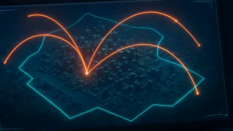

By embedding pre-approved flight parameters into a digital framework, Dubai ensures that any deviation from a certified flight path triggers an instantaneous security alert. This advancement centers on the Dubai Civil Aviation Monitoring System (DMS), a sophisticated platform that serves as a cornerstone for the city’s aviation safety strategy. Managed by the Dubai Civil Aviation Authority (DCAA), this system has moved the region away from traditional, reactive oversight into a proactive, 24/7 digital environment. The goal is to provide a shield for major international carriers like Emirates and flydubai, ensuring that their critical flight paths remain free from interference by the growing number of unauthorized drones and low-altitude aircraft. As the skies become more crowded with diverse aerial vehicles, the DMS provides a necessary layer of automated protection that adapts to real-time challenges. This innovation marks a fundamental shift in how urban centers manage complex, high-density air traffic.
Automated Monitoring and Digital Perimeter Management
The operational success of the system relies heavily on the integration of artificial intelligence to process vast amounts of telemetry data. Before any flight operation can take place, drone operators are required to obtain a No-Objection Certificate (NOC) through a digital portal. This certificate specifies the exact geographical boundaries and timeframes for the intended flight, which the AI then uses to create a “digital fence” around the operation. If a drone crosses these predetermined boundaries or operates outside its scheduled window, the system automatically detects the anomaly and flags it immediately. This level of automation removes the delays associated with manual tracking and provides regulatory authorities with a high-definition view of the entire low-altitude landscape. By standardizing these protocols, the city has created a predictable environment where legitimate operators can flourish while security risks are minimized through precise, data-driven monitoring and automated logging.
Beyond monitoring commercial and private drones, the platform encompasses a wide range of aerial hazards and activities that could impact general flight safety. This holistic approach includes tracking ground-based structures such as construction cranes, high-voltage power towers, and telecommunications masts, ensuring they do not encroach upon active flight paths. The system also manages permissions and schedules for special events including large-scale fireworks displays, laser shows, and skydiving activities. By centralizing these diverse variables into a single digital interface, the DCAA ensures that every potential obstacle is accounted for in real-time. This comprehensive situational awareness allows for better coordination between urban development and aviation safety. The ability to monitor permanent and temporary hazards simultaneously provides a level of detail that is essential for a city constantly expanding its skyline. Consequently, the sky remains a safe corridor for both traditional aviation and the new era of aerial mobility solutions.
Human Oversight and Technical Validation Protocols
While the artificial intelligence handles the bulk of the data processing and initial detection, a dedicated control room ensures that a “human-in-the-loop” strategy remains central to operations. This facility serves as a quality assurance hub where experienced officers review flagged incidents to verify the nature of the violation. The AI is highly efficient at identifying deviations, but human judgment is still required to distinguish between a willful regulatory breach and a technical malfunction. For instance, extreme environmental factors such as high-altitude winds or pressure sensor errors can occasionally cause a drone to drift from its path without the operator’s intent. Human operators analyze these variables, checking weather data and equipment logs before initiating enforcement actions. This collaborative approach between machine efficiency and human expertise prevents unnecessary penalties and ensures that the regulatory framework remains fair and accurate. It also provides a feedback loop that helps refine the AI algorithms over time to better understand environmental anomalies.
The technical validation process also plays a critical role in maintaining the integrity of the data collected by the monitoring system. When an alert is triggered, the system records a comprehensive set of data points, including altitude, speed, and precise GPS coordinates. This information is cross-referenced with the operator’s digital identity and the certification of the aircraft. By maintaining such detailed records, the DCAA can provide irrefutable evidence in the event of a dispute or a serious safety incident. The use of Radio Frequency Identification (RFID) tags on authorized drones further enhances this identification process, allowing the system to verify the legitimacy of a signal within seconds. This layer of verification ensures that all participants in the airspace are accountable and that the data used for safety decisions is of the highest quality. The focus on technical accuracy has established the DMS as one of the most reliable aviation monitoring platforms globally, setting a high standard for other metropolitan areas to follow in the management of their own urban airspace.
Strategic Partnerships and Law Enforcement Coordination
Security in the airspace is significantly strengthened through a seamless partnership between civil aviation authorities and the Dubai Police. When the monitoring system identifies a persistent or unauthorized flight, it automatically relays the location and operator data to the Dubai Police Drone Team. This allows for the rapid deployment of patrol units to the ground location of the operator to conduct physical inspections. These officers are trained to verify the operator’s credentials, inspect the drone for mandatory safety equipment, and ensure that the flight conforms to the issued permit. This synergy between digital detection and physical enforcement creates a strong deterrent against unregulated aerial activity. By bridging the gap between the virtual monitoring room and the physical world, the city has established a robust law enforcement framework that protects both public safety and commercial interests. This collaborative model ensures that any potential threats are neutralized before they can interfere with critical infrastructure or endanger the public on the ground.
The implementation of the Dubai Civil Aviation Monitoring System represented a pivotal moment in the modernization of urban transport and safety. It was recognized that as the drone sector expanded from hobbyist use to essential services like medical deliveries and infrastructure inspections, a legacy manual approach would no longer suffice. The authority successfully established a digital architecture that balanced the needs of innovation with the non-negotiable requirements of passenger jet safety. By integrating AI-driven monitoring with real-time law enforcement, the project achieved a high level of compliance and transparency across the low-altitude airspace. The system paved the way for the safe introduction of autonomous air taxis, providing the necessary “sky lanes” for future mobility. Authorities focused on creating a scalable model that could adapt to the rapid technological shifts occurring throughout 2026. Ultimately, the transition to this automated ecosystem secured the city’s position as a global leader in aviation technology, proving that safety and innovation could coexist through disciplined digital transformation.